


New map reveals hidden landscape under Antarctica’s ice sheet
Researchers used high-resolution satellites and ice-flow analysis to map Antarctica’s hidden terrain
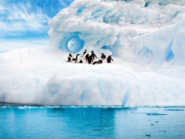
A glacier in Antarctica. PHOTO: PIXABAY
Scientists have devised the most detailed map to date of the terrain hidden beneath Antarctica’s vast ice sheet, uncovering a dramatic landscape of mountains, canyons, valleys and plains, while identifying tens of thousands of previously unknown hills and smaller features.
Researchers used the latest high-resolution satellite observations and a technique known as ice-flow perturbation analysis, which estimates subglacial topography and conditions based on surface features, to map the entire continent, including previously uncharted regions.
Improved knowledge of the subglacial bedrock landscape may help scientists better forecast climate-driven retreat of Antarctica’s ice sheet. Previous research has shown that rough terrain, such as jagged hillsides and mountaintops, can slow ice loss.
“Having the most accurate map of Antarctica’s bed shape is crucial, because the shape of the bed is an important control on friction acting against ice flow,” said glaciologist Robert Bingham of the University of Edinburgh in Scotland, who helped lead the study published this week in the journal Science. “This must be included in numerical models that project how rapidly Antarctica’s ice will flow towards the ocean, melt and contribute to global sea-level rise.”
The new map offers unprecedented precision. Researchers identified more than 30,000 previously uncharted hills, defined as terrain protrusions of at least 165 feet (50 metres).
Antarctica is about 40% larger than Europe, 50% larger than the United States and roughly half the area of Africa. “Like other continents, Antarctica contains vast extremes, from towering mountain ranges to immense flat plains,” Bingham said. “Boring it is not.”
The Antarctic Ice Sheet is the largest mass of ice on Earth, holding about 70% of the planet’s freshwater. Its average thickness is about 1.3 miles (2.1 km), with a maximum thickness of roughly 3 miles (4.8 km).
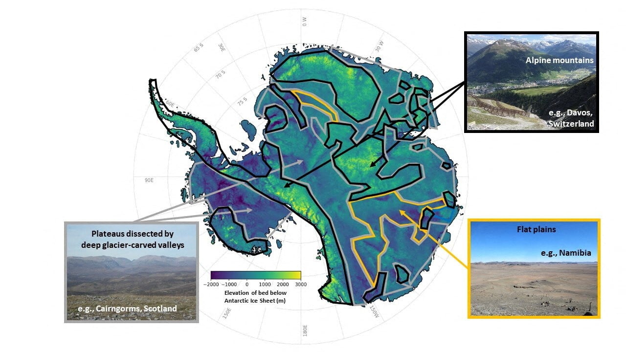
An undated handout image of a map illustrating the subglacial landscape of mountain ranges, deep canyons and wide valleys, as well as tens of thousands of smaller hills and valleys, with comparative examples inset, in Antarctica, obtained by Reuters on January 15, 2026. Robert Bingham, University of Edinburgh/Reuters
Antarctica has not always been ice-covered. Its subglacial features were initially sculpted more than 34 million years ago before the continent acquired its icy covering, and were later modified by the dynamic ice sheet. The continent was once connected to South America before drifting apart through plate tectonics.
The map revealed a variety of topographical features, including plateaus dissected by deep glacier-carved valleys. “This type of landscape is familiar in places like Scotland, Scandinavia, northern Canada and Greenland,” Bingham said, adding that the similarity boosts confidence in the new mapping technique.
Until now, the surface of Mars was better mapped than Antarctica’s subglacial terrain.
Traditionally, scientists have mapped the landscape beneath Antarctica’s ice using radar equipment mounted on aircraft or towed by snowmobiles, said glaciologist Helen Ockenden of France’s Institut des Géosciences de l’Environnement, the study’s lead author. These surveys often left gaps of 5 to 10 km, and sometimes as much as 150 km.
The new method combines mathematical modelling of ice flow with high-resolution satellite observations to infer what the landscape beneath the ice looks like across the entire continent, including in those gaps, Ockenden said.
Researchers hope the map will improve projections of future sea-level rise and help inform forecasts by the IPCC, the U.N. Intergovernmental Panel on Climate Change.
“We can now better identify where Antarctica needs more detailed field surveys, and where it does not,” Bingham added.